
Vaizdas:1799 Clement Cruttwell Map of Poland and Lithuania - Geographicus - Poland-cruttwell-1799.jpg
Šios peržiūros dydis: 705 × 599 taškų. Kitos 6 rezoliucijos: 282 × 240 taškų | 565 × 480 taškų | 903 × 768 taškų | 1 205 × 1 024 taškų | 2 409 × 2 048 taškų | 4 931 × 4 192 taškų.
Pradinė rinkmena (4 931 × 4 192 taškų, rinkmenos dydis: 5,43 MiB, MIME tipas: image/jpeg)
| Poland. | ||||||
|---|---|---|---|---|---|---|
| Autorius | ||||||
| Pavadinimas |
Poland. |
|||||
| Aprašymas |
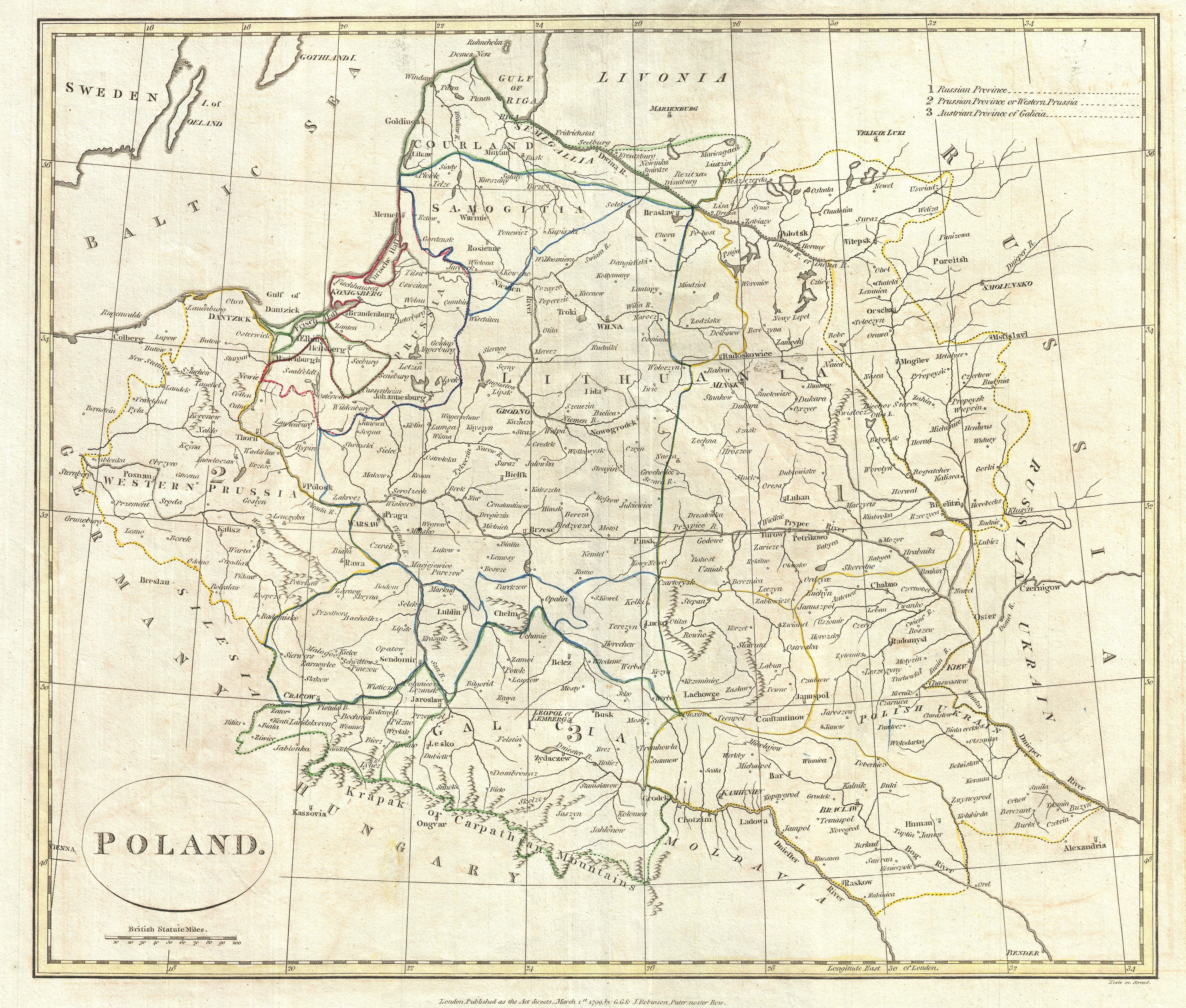
English: A fine 1799 map of Poland by the English mapmaker Clement Cruttwell. Shows the partitioning of the Polish-Lithuanian Commonwealth in 1765-1795 between Prussia, Austria, and Russia. The map covers the area from Poznan in the west to just west of Kiev in the east, and from as far south as Moldavan border. Makes note in the upper-right quadrant of the three partitioned areas: Russia, Prussia, and Austria. Russia claimed the bulk of what once comprised the Grand Duchy of Lithuania from Livonia south to Moldava. Prussia took hold of the area east of Warsaw, while Austria held claim to the area as far south as Galicia. Detailed borders also show the regions of Courland, Samoglita, and the Polish Ukraine. Outline color and fine copper plate engraving in the minimalist English style prevalent in the late 18th and early 19th centuries. Mountains and topographical other detail shown by profile. Also makes note of rivers and some offshore shoals. Drawn by Clement Cruttwell and published in the 1799 Atlas to Cruttwell's Gazetteer. |
|||||
| Data | 1799 m. (dated) | |||||
| Matmenys | aukštis: 13,5 in (34,2 cm); plotis: 16 in (40,6 cm) | |||||
| Leidimo numeris |
Geographicus link: Poland-cruttwell-1799 |
|||||
| Šaltinis/Fotografas |
Cruttwell, C., Atlas to Cruttwell's Gazetteer, 1799.
|
|||||
| Leidimas (Šios rinkmenos panaudojimas kitur) |
|
|||||
Rinkmenos istorija
Paspauskite ant datos/laiko, kad pamatytumėte rinkmeną tokią, kokia ji buvo tuo metu.
| Data/Laikas | Miniatiūra | Matmenys | Naudotojas | Paaiškinimas | |
|---|---|---|---|---|---|
| dabartinis | 16:13, 24 kovo 2011 | | 4 931 × 4 192 (5,43 MiB) | BotMultichillT | {{subst:User:Multichill/Geographicus |link=http://www.geographicus.com/P/AntiqueMap/Poland-cruttwell-1799 |product_name=1799 Clement Cruttwell Map of Poland and Lithuania |map_title=Poland. |description=A fine 1799 map of Poland by the English mapmaker Cl |
Rinkmenos naudojimas
Šis puslapis naudoja šią rinkmeną: